For all your walking, running, hiking and swimming needs! Free shipping within Canada on orders over $150. Now serving customers in the continental USA.
- Home
- Shop Now
- Courses, Groups, Events and Links
- Rentals
- Gift cards
- Brands
Your cart is currently empty
Product image slideshow Items

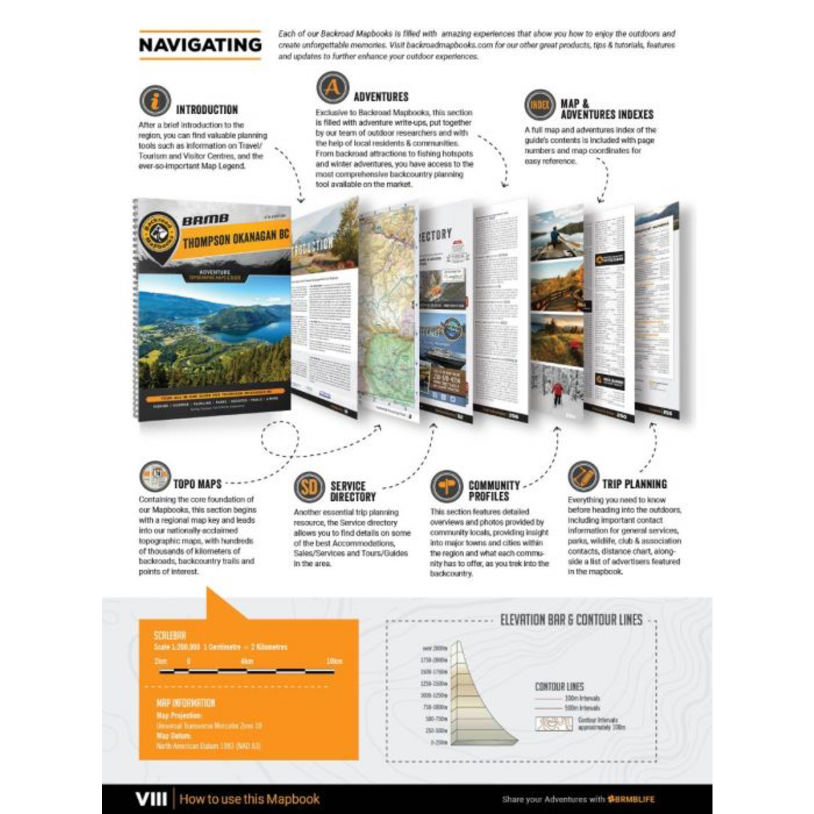

Pages: 268
Dimensions: 21.5cm x 28cm (8.5" x 11")
Maps: 51 topo maps @ 1:200,000
Covering the heart of BC's interior, including the cities of Kamloops, Kelowna, Merritt and Penticton, this Mapbook is your ultimate guide to camping, hiking, fishing, ATVing, snowmobiling, hunting, cross-country skiing, paddling and more in this incredible region. From the lush forests of EC Manning Provincial Park to the sparkling waters of Okanagan Lake, the arid desert landscape around Osoyoos, the pristine beaches of the Shuswap and the vast wilderness of Wells Gray Provincial Park, the Thompson Okanagan is an outdoor explorer's paradise.
The 6th Edition Thompson Okanagan Backroad Mapbook features several additions and expansions from our last edition. In addition to an updated and expanded Community Profiles section, there have been several additions to the Adventure listings including updated fish stocking and hiking trail charts, new multi-day overland driving routes for off-road enthusiasts and a new Rock Climbing Adventure section. Our maps now feature private and leased land, labelled sportfish species for lakes and rivers, plus countless new recreation POI's, roads, trails and paddling routes.
The printed version of the mapbook comes in the convenient 21.5 x 28 cm (8.5 x 11 inch) mapbook format with a heavy-duty spiral-bound cover. The 268 page book includes 51 maps at 1:200,000 scale, along with a dozen Outdoor Adventure sections, a Service Provider Directory, Map and Adventure Index, Trip Planning tools and more. With over 140,000 kilometres of roads to view including the most complete logging and industrial road coverage available, the books are ideal for navigating on road trips and planning from home.
Map Features: Highways, Logging Roads, Land & Water Features, Parks, Adventure Points of Interest, Campgrounds, Hiking Trails, Motorized Trails, Paddling Routes, Hunting & Fishing Areas, Winter Recreation and More.
Areas Covered: Cache Creek, Clearwater, Grand Forks, Kamloops, Kelowna, McBride, Merritt, Penticton, Princeton, Salmon Arm, Savona, Valemount, Vernon, & more
Product carousel items


